Todwick Ramblers Club Walks: 2015
27th December 2015
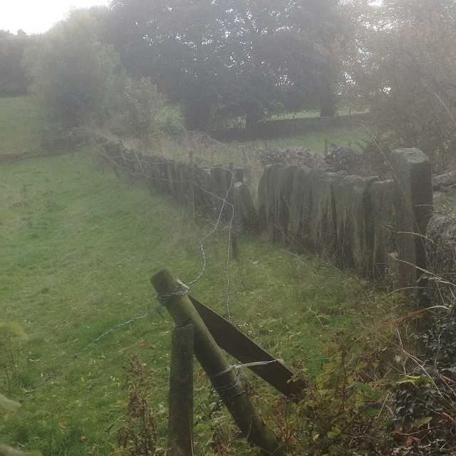
Maltby – Hooton Levitt – Gipsy Lane – Roche Abbey – Maltby Dyke – Norwood – Maltby Church
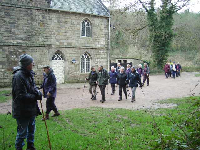
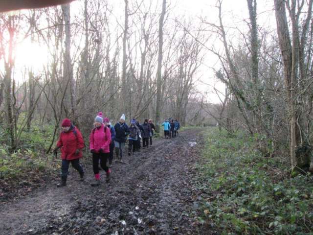
On Monday, 27 December 2015, 23 members took advantage of the pleasant spring-like weather conditions by meeting up in Maltby to enjoy a 6-mile circular ramble that after an initial gentle ascent to the village of Hooton Levitt followed field paths that continued to provide good views over the rooftops of Maltby and beyond.
After about 3 miles the route meandered gently downhill to join Gipsy Lane before entering the grounds of the Roche Abbey estate. Here the group paused by the old Gate House to take in a leisurely coffee break with seasonal fare much in evidence.
It was at this point that the group received information that one of the club’s members present on the walk was celebrating a birthday. This encouraged the group to give a lusty rendition of the Happy Birthday jingle.


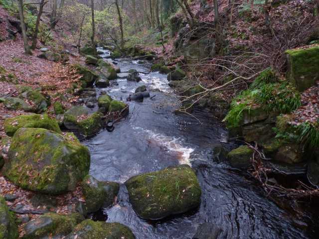
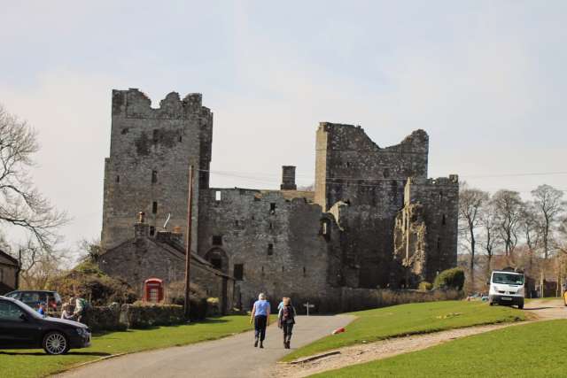
Continuing on our way we admired the workmanship still very evident within the ruins of the Abbey before crossing over a rushing stream via rather slippery stepping stones.
On leaving Roche Abbey we returned to Maltby using the broad track that generally follows the course of the Maltby Dyke as it meanders through the Norwood with its wide variety of trees, before entering open parkland where we followed a path that returned us to the pleasant surroundings of Maltby Church.
Jim Tompkin
13th December 2015
Ulley Country Park – Stocket Lane – Penny Hill Lane – Carr Lane – Ulley
A surprisingly large number of 21 walkers, including some new to the group, arrived at Ulley Country Park ready to walk. After a lot of rain the previous day it was very wet underfoot, but fortunately stayed dry for the walk.
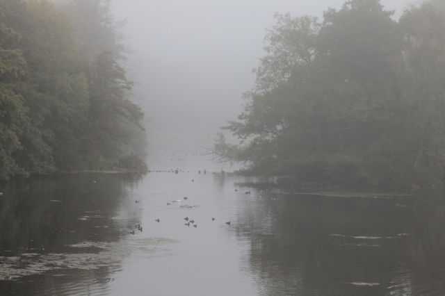
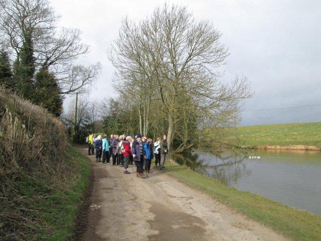
We set off following the path beside the main reservoir, over the road and beside the Laughton arm of the reservoir. It was quite atmospheric with a light mist hanging over the swollen reservoir. Most of us could recognize the various water birds, swans, coots, grebes and mallards, but Brian pointed out a small flock of siskins and we were able to watch them feeding on seed from alder cones. We then continued on the footpath alongside the stream heading away from the reservoir. At Stocket Lane, a hedge-lined ancient track, we climbed uphill stopping near the top for a rest and opportunity for a drink and snack.
When we set off again we soon reached Penny Hill Lane and walked along this road for a short way. We then followed a permissive path, which led us alongside fields, in places very wet and muddy before bringing us out onto Carr Lane. This brought us into the village of Ulley, we walked through the village for a short way before taking the footpath down a steep hill to reach the stream of our outward journey. We then retraced our steps to the reservoir returning on the other side of the Laughton arm, still no sightings of the fabled terrapin, over the bridge and back to the car park.
The Friends of Ulley Country Park were holding one of their monthly Café Days so many of the group went in and enjoyed warming soup and delicious homemade cakes as well as a welcome opportunity to sit down!
The walk was relatively short, between 4 and 5 miles, mostly Doorstep Walk No. 6 with an additional loop from Walk No. 7.
20th November 2015
Longshaw House – Burbage Brook – Padley Gorge Wood – River Derwent – Padley Chapel – Grindleford Station
Despite the poor weather forecast 12 intrepid walkers arrived at the Longshaw car park for our ramble around the Estate. The National Trust acquired the Estate in 1931 from Sheffield Council. We left Longshaw House in bright sunny weather and made our way alongside the Burbage Brook and into Padley Gorge Wood. The path downhill needed care, it was wet, muddy, slippery and strewn with leaves, roots and boulders, however a beautiful woodland walk. This is a popular site with birdwatchers, two of our most attractive summer visitors, Redstart and Pied Flycatcher breed here.
A break was taken at by Padley Chapel in glorious sunshine. In Elizabethan times two priests were arrested from this Catholic Chapel, taken to Derby prison then hung, drawn and quartered as traitors – a grizzly end! A service is held each summer to commemorate this horrible event.
Heavy rain started as soon as the walk was resumed, showers, heavy and light stayed with us for the rest of the way – as forecast. We progressed through more beautiful oak woodland to eventually reach the River Derwent. A flat stroll alongside the river was followed by a climb back to Padley Chapel and on to Grindleford Station. The wet and cold party had a welcome break in the Walkers Café. Hot mugs of tea plus snacks by a coal fire were most welcome.


The walk then took us back through Padley Wood, at first on the other side of the brook then across a bridge to resume our original route. Steps down to the bridge and up the other side again needed some care. After emerging from the wood the local road was crossed to Granby Barn and so back to base. The pond on this section held a pair of Mandarin Ducks, an unexpected surprise.
The walk was approximately 6.5 miles, the weather and conditions underfoot making for quite a challenge. Possibly a repeat of the walk in the summer would be a good idea.
Brian & Rosemary Chambers
8th November 2015
Nether Booth – Woodhouse Farm – Nether Ollerbrook – Ollerbrook Booth – Edale Village – Upper Booth – Barber Booth – Edale Village – Nether Booth
The weather forecast was dire. The main road through Hope Valley was closed. Amazingly, 16 intrepid souls turned up at Nether Booth for a stroll up the Vale of Edale. We delayed the start to allow any latecomers to negotiate the road diversions and set off westwards.
The rain was holding off and soon we heard the note of a single bell tolling at Edale Church, signalling the approaching 11 am on Remembrance Sunday. When the bell fell silent, so did we. We stood for a minute, in silence, in a silent, beautiful landscape before continuing our walk. Soon we crossed Grinds Brook into Edale village where we came to the start of the Pennine Way, 267 miles long, but we did just over 1 mile of it.
As we approached the valley head we had a good view of Brown Knoll, mist shrouding its 1,867 feet top, where lies wreckage of an RAF plane which crashed in poor weather on 28th December 1945. The four crew were badly injured but one, pilot Ted Croker, wrapped the other three in parachutes and crawled, with both ankles broken, into Edale for help. He was 21 years old and will be remembered as Secretary of the FA from 1973 to 1989.
At Upper Booth we left the Pennine Way, walking gradually downhill into Barber Booth and from there back to Edale Village where we called in the Peak National Park Information Centre and then retraced our steps to Nether Booth. It rained for the last few minutes of our 5.7 miles. Naa naa weathermen!
Nigel Singleton
21st October 2015
Ashover – Handley Village – Ogston Reservoir – Milltown Village – Ashover
On Wednesday, 21 October 2015, the Todwick Ramblers enjoyed a walk of around 7 miles from the pretty Derbyshire village of Ashover. Fortunately, the overnight rain had stopped by the start of the walk at 10 am and the weather steadily improved throughout the day. Starting at the Parish Hall car park, the route soon climbed through farmland up the northern flank of the valley passing one or two historic buildings. Descending from Handley village the path crossed several fields to arrive at the edge of Ogston Reservoir and soon afterwards the group arrived at their lunch stop at the picnic area from where the waterfowl could be viewed.
The return leg of the walk followed field and woodland paths to Milltown village. Then, after skirting the edge of the quarry, the route steadily ascended on an often rocky and leaf-strewn path to arrive on the hillside overlooking Ashover. From there, the group walked downhill on a path that was slippery at times to reach the village by the side of the Poets Corner pub and hence back to the car park.
Ken Whetter
11th October 2015
Wellow village – Eakring – Loundwood – Leyfields Farm – Ompton – Shortwood Farm – Cocking Moor – Jordan Castle – Wellow
Our walk started in the lovely village of Wellow just south of Ollerton. We started from the village green with its huge Maypole and set off on the road towards Eakring. After half a mile we headed west to the disused railway line that leaves Ollerton heading south. As this line ends in a massive bramble bush we had to take the path to North Laithes passing through the poultry farm and then on southeast to the outskirts of Eakring. Before entering Eakring we took a path northwards past a small but well hidden lake and then on over fields to Loundwood and then over more fields to Leyfields Farm.
We continued in this general direction skirting round the village of Ompton reaching Shortwood Farm where we had a break for lunch. Our route then took us along a bridleway and fields to Cocking Moor and thence into Wellow Park Wood. We headed west through the wood towards Jordan Castle which we could not visit as it is on private land. We had to pass this on its southern perimeter along a permissive path back to Wellow. We had covered 8 miles in just over 4 hours on a lovely sunny day. Everyone completed the walk tired but well satisfied with our little adventure.
Neil Hawksworth
29th September 2015
Clumber Park – Thoresby Border – Drayton Gate – Normanton Gate – Hardwick Village – Ash Tree Hill Wood
14 club members met in the main car park in Clumber Park on a misty early autumn morning for a 10.00 am start. The weather forecast was for a dry and generally sunny day and this proved to be the case with the mist soon disappearing.
A brief stop was made on Clumber Bridge to view the mist still hanging over the lake before entering Beech Drive to walk up the steady incline through the wood towards South Lodge. The walk then continued along Thoresby Border stopping for the first coffee break about 2.5 miles into the walk. Suitably refreshed we continued to Drayton Gate and Normanton Gate before crossing fields and the footbridge over the River Poulter. Stopping on the footbridge a kingfisher was spotted before the final stretch into Hardwick Village where a stop was made for lunch.

An option was presented here if anyone wanted to leave before the rest of the walk and return directly to the main car park. However, everyone agreed to continue on the planned full walk which took us out of Hardwick Village and across agricultural land. The fields contained corn on the cob and some of the ramblers could not resist picking one to try. The route took us through some beautiful woodland before making another coffee stop where the two available benches were made use of. A buzzard was spotted flying above the trees. The place was a real sun trap and it was with some reluctance that we had to leave to continue the ramble which took us across a number of fields to pass an old school house which we assume was in use many years ago as part of the estate. The house was unusual in that it was hexagonal in shape.
The final part of the walk took us down to the lake where cormorants were seen and then through Ash Tree Hill Wood, a strange name as the wood contains no ash trees and then back to the main car park. The walk length was 7.8 miles and although most ramblers were tired they appeared to have enjoyed the day.
Many thanks to all who came on the walk.
Ernest and Judy.
23rd August 2015
Todwick – Storth Lane – Nickerwood Farm, Aston – Todwick
Our second club walk for August again concentrated on food and eating. Following our previous walk and pie and pea supper, this time a mid-afternoon BBQ provided by members John and Jenny.
A 1.00 pm start in warm sunshine from Todwick News Agency for the 14 walkers took us via Storth Lane, Wales, and Nickerwood Farm to the Aston home of John and Jenny for the BBQ where we were joined by a further 18 members and guest. Although what they had prepared was more of a banquet than the traditional barbecue fare of burnt sausages and underdone burgers.


Seated in the garden, the wine waitress, Michelle, assisted by her two delightful young helpers Max and Darcie, supplied us with drinks before the starter fish course comprising of cod, salmon and a selection of shellfish was served.
This was followed by a selection of meats, salads and Mediterranean vegetables, and finished with a large selection of “naughty but nice” deserts. Fortunately most of us had finished eating before the forecast heavy rain arrived, forcing us inside to complete Jenny’s quiz.
The intention was to walk back to Todwick, however with the heavy rain and the number of lifts available, not to mention the quantity of wine consumed by some of the walkers, all arrived back at Todwick by car.
A huge thank you to John and Jenny, and a special thank you to their family Max, Michelle, and the delightful grandchildren Max and Darcie for putting on this event which we intend to repeat next year.
Terry Calladine
5th August 2015
Todwick (Greenscene Garden Centre, off A57) – Chesterfield Canal – Anston Stones – Todwick (Greenbean Coffee Shop) – Evening Ramble followed by Pie & Pea Supper
8 ramblers met up for a 3.00 p.m. start at the Greenscene Garden Centre car park to embark on a local walk and rounding off the evening with something different. We were to return to the Greenbean Coffee Shop for a pre-booked Pie & Pea Supper.
On setting off the weather was fine and cloudy with the promise of showers later. We followed the field side path just to the east of Greenscene to aim for Todwick Church where another 8 walkers were waiting to join us. We proceeded through the churchyard and onto Kiveton Lane where 2 more people jumped aboard our walking bus. On arriving at Kiveton Hall Farm we collected another passenger. We then left the tarmaced footpath and headed off behind the farm to cross newly harvested and cultivated fields. Arriving at Kiveton Park Station we firstly took the footpath adjacent to the railway line before joining the Chesterfield Canal towpath. At this point we were already beginning to experience some of the promised fine drizzle. Fortunately it did not last very long as we turned away from the canal to cross the railway line to head off up the dreaded long uphill to South Anston where a pea viner was working in the field instigating some of our group to help themselves to some discarded pods to sample the contents. At the top of the hill we had our first coffee stop to recover from our climb, after which our final 2 ramblers joined us making 21 in total.
We then continued on and safely crossed the A57 and took the footpath next to Wainwrights Garage before entering Anston Stones. Here we did a very pleasant shortened circuit of the wood by first taking the path up through the colourful wild flower meadow of the Little Stones before entering the wood soon to descend some steps to re-join the lower path which follows the course of Anston Brook before crossing Ryton Road and entering Brook Walk. Here we had a very short coffee stop as by now time was moving on and everyone had supper in mind. The weather was now much brighter and we were experiencing some welcome sunshine.
On turning south part way along Brook Walk we walked through a tunnel and under a railway line which is the mineral line through Anston Stones which joins the Sheffield to Worksop railway line at Brancliffe Junction near Turnerwood and in the other direction goes through to Doncaster. We then walked a couple of ginnels through a housing estate to arrive back and cross the A57 to take another footpath which brought us out beside South Anston Methodist Church where we crossed onto West Street and Crowgate before finally leaving the tarmac and turning onto Axle Lane for the last leg of our walk back to Todwick.
We arrived back at Greenscene at 6.40 p.m. after walking approximately 6.75 miles, well at least some of us had, but then some people, who had joined us along the way, then walked back home. Thanks go to Jean, David and Staff for an excellent supper which we all enjoyed including another 9 non-walking members and friends who joined us for the meal. This was something different for the Club which as well as supporting a local business made it more of a social event which seemed to go down very well as the question was asked, “when are we doing this again?”.
On this occasion the Greenbean Coffee Shop had opened especially for us. Their Wednesday Pie and Peas Evenings began earlier in the year but have been suspended for the summer. They will be restarting on Wednesday 9th September with this weekly event.
Sue Parker
22nd July 2015
Laughton – Slade Hooton – Roche Abbey
Fifteen members met in the car park of the Village Hall in Laughton ready to set out on this walk. We walked across the fields to the South and West of the village, then down to Brookhouse. We had a short coffee break at the bottom of the hill behind The Traveller’s Rest.
On an earlier walk we had discovered that the footpath was seriously overgrown with brambles so we detoured along the road to Slade Hooton, then we were able to continue on a clear, well surfaced footpath. The path took us through a field of wheat and then alongside a Dyke and into King’s Wood. Everyone bravely negotiated the stepping stones and arrived at the Abbey ruins, where we settled down to eat our sandwiches. The visitor centre was open so we were able to take advantage of the facilities and buy drinks and ice creams.


After a leisurely lunch we set off back to Laughton, through the woods and up a short steep hill, then it was a fairly level walk back to Laughton with views over the paths we had taken earlier. It was cloudy, but ideal walking weather, there were a few spots of rain but most of us did not feel the need to get out waterproofs. The general consensus of opinion was that it was about 5.75 miles and a pleasant and enjoyable walk.
Marion Brassington
8th July 2015
Wentworth Castle – Lowe Wood – Hood Green – Bagger Wood – Wentworth Castle
With the outlook for fine weather looking a little uncertain, 13 members gathered in the car park of Wentworth Castle on 8th July 2015 to begin our circular walk.
After passing through Lowe Wood, an area thick with old mine workings, we climbed up to the village of Hood Green for a coffee break on the village green. Bagger Wood came next, a large wood owned by the Woodland Trust, before moving into the beautiful undulating countryside south of the castle. Mixed weather followed as we made our way round to the southern entrance to the deer park. From there the distant views of the castle drew us back to our starting point.
In total the walk was five and three quarter miles finishing at the Visitors Centre. This was voted as having the best ladies toilet facilities seen for many a walk.
Anne Warburton
24th June 2015
Linacre Reservoir – Holme Brook Valley – Wigley – Bagthorpe Lane – Hipper Valley – Westwick Lane – Westwick Farm – Old Brampton Church – Linacre
Our latest walk on 24 June 2015 again centred on the beautiful rolling countryside just to the west of Chesterfield. The starting point being the car park at Linacre Reservoir, the former site of Linacre House, evidence of which has long since disappeared. The house was the home of Dr Linacre who was president of the Royal College of Surgeons and physician to both Henry VIII and the young Mary Queen of Scots.
The 17 members strode out purposely in the lovely summer sun along the north banks of the three reservoirs under the shade of the oak, beach and sycamore trees. Continuing in the same direction we emerged from to woods into Holme Brook valley where we took our coffee break.
Fully refreshed we crossed over the brook to climb up through the woods to the hamlet of Wigley, passing the village school which has recently celebrated its 125 year anniversary.


After a short section of road walking, we turned down Bagthorpe Lane to follow the Hipper Valley for about 2 miles, passing typical Derbyshire farmhouses to emerge onto Westwick Lane and descending to our lunch stop at Westwick Farm.
Once again refreshed we then proceeded up a rough track to Old Brampton Church. The church clock is unique in having 63 minute painted on its face, a fact that not any of our walkers could spot.
A short downhill walk along lanes and fields took us back to our start point at Linacre.
Terry Calladine
5th June 2015
Shades of Robin Hood – Sherwood Forest – Majestic Oak – Visitors Centre – Home
On a warm and sunny day (yes, we have had one) on Friday, 5 June 2015, seventeen members enjoyed a six-mile hike down leafy forest tracks in Sherwood Forest. The paths were flat and easy, with plenty of opportunity to enjoy the wild flowers, the cuckoo calling and the gnarled and twisted ancient oak trees.
We passed the huge and majestic Major Oak, still very impressive despite the numerous props and supports, and finished the walk at the Visitors Centre... coffees, ice-creams, WCs, Robin Hood hats, bows and arrows... what more could we need!
Rosemary and Brian Chambers
22nd May 2015
Harthill – Woodall – Baugy Hill – Cuckoo Way – Wales – Storth Lane
24 members took advantage of the seasonal daylight hours to enjoy a 5.5 mile evening ramble that commenced in Harthill.
The weather was cool and overcast for the walk, which initially followed the Western banks of the three lakes that make up the total area of Harthill Reservoir, before making use of a recently created path that provides access to the Southern end of the reservoir.


On leaving the reservoir we tackled a gentle climb that followed a hedge-line to give us access to a green-lane which provided an introduction to the attractive village of Woodall. Our route continued through the village, where we admired the colourful displays of Spring flowers in the well-kept gardens.
At the point where the village gives way to the open countryside we lingered awhile to enjoy a coffee break before continuing our walk by ascending Baugy Hill. This provided fine views over Kiveton and Harthill on one side, with views towards Derbyshire on the other. After the descent of Baugy Hill we continued to a junction of paths to follow a section of the Cuckoo Way that enabled us to make our way to the Wales Parish Hall and playing fields complex.
Here the party opted to take a late break, and enjoy a sundowner drink in the Parish Hall Lamp and Pony bar. For some however, the mouth-watering smell of fish and chips across the way proved to be irresistible, so at this point the group became briefly split up.
Fortunately thirsts were quenched and hunger pangs assuaged at the same time, enabling everybody to regroup, and journey the last ¾ mile back to Todwick via Storth Lane.
Jim Tompkin
10th May 2015
A57 – Hardwick Grange Farm – Monks Trod – Brampton Straight Mile – Brampton Common Farm – Hawk Hill Lane – Vessey Close Farm – Hardwick Lane – A57 – Common Farm Aston – Goosecarr Lane
On the breezy but bright morning of the 10 May 2015, nineteen members set out on a 6.25 mile walk, taking us firstly over some fields and then across the A57.
After taking the bridleway near Orchard Cottage we reached Hardwick Grange Farm and the village pond, where several men were sat fishing. This led us to a path known locally as Monks Trod, where two of our members took a small tumble, but no damage done. After crossing what is known as ‘Brampton Straight Mile’ we passed through a gate and along a wide track taking us to the ruins of Brampton Common Farm, where a well-earned rest was taken.
Shortly after setting off again we entered a field full of very lively cattle, some supporting very large horns and worrying some of our members, but no harm done thankfully. We then accessed Hawk Hill Lane to the crossroads, where we passed through 3 large arable fields before reaching Vessey Close Farm. After this the motorway was in view and we then knew we were on the homeward stretch, down Hardwick Lane, across a field and once again across the A57 towards Common Farm Aston, where we crossed a paddock and another arable field which brought us back to Goosecarr Lane and home.
Jim Tompkins
7th, 8th & 9th April 2015 – Mad Mick’s Wensleydale Jolly
Tuesday. 19 Todwick ramblers met at the Wheatsheaf Hotel in the charming village of Carperby for a short walk to Aysgarth Falls. The local stone stiles are not called squeeze stiles for nothing, but with the aid of a jar of Vaseline we all got through. We walked to the upper falls, middle falls and lower falls, also taking in St. Andrew’s church. On the way back Mr. T. Rouble took over as unofficial leader and led everybody astray, luckily Mad Mick and Neil came to the rescue and got them back on the right path. The squeeze stiles were at it again as Mr. T. Rouble stumbles and launched Bob the dog through the stile quickly followed by himself, very spectacular and fortunately no injuries. The whole party ate in the Wheatsheaf which serves excellent food.
Wednesday and the main walk. Another sunny day. For this walk we used a section of the path from yesterday. This promoted Ernie to put up a reward of a pint of Black Sheep real ale if anyone could find his lens cap lost the previous day. No luck not found. There were one or two wet parts as we followed the fields to Redmire village green for our coffee stop. Redmire is another charming village and also the end of the Wensleydale Preservation Railway.
After leaving Redmire we walked a short stretch of the old railway line and then a steady climb to the lunch stop on the benches and stone well next to Bolton Castle. This was built in the 14th century by Richard 1st Baron Scrope of Bolton.
The next track has great views across the valley for a couple of miles before dropping down to Carperby and into the hotel for a well earned pint of Black Sheep. Even a couple of our ladies tried some. A total of nine miles which surprised some of our ramblers, who didn’t know they had it in them. Another good meal followed by the cabaret put on by Mat, the tap dancing was especially good as he has a wooden leg.


Thursday. Time to settle bills and drive over to Bainbridge for the third of our walks. This river walk is from a book belonging to Mr. T. Rouble and recommended by Bob. We did see the river Bain briefly at the start but it soon disappeared as we climbed a long steep hill and through more squeeze stiles which were now becoming easier with practice. Along the top for a while before dropping back down to river level and some easy going although one gate was very boggy. The group settled down on a grassy bank at the side of Semer Water for our lunch stop, we somehow stayed longer than anticipated probably due to the lovely surroundings, or it could have been we needed a long rest before climbing a very steep road to Courtersett, luckily some kind person had placed a bench at the top for weary walkers. A bit more road work before we took a stile leading across some fields to a very steep ladder stile which took several people to manoeuvre Bob over. A little bit more up and down with beautiful views over Bainbridge Pastures and then downhill and back into Bainbridge.
The star of the walks has to be Bob the dog despite his recent stroke did all three walks – a real hero.
Thanks to all the Ramblers that came and made it such an enjoyable event.
Mad Mick
22nd March 2015
Shireoaks Marina – Chesterfield Canal – Lindrick Common – Anston Stones Wood – Anston Grange Farm – Lindrick Dale – Moses Seat woods
On Sunday, 22 March 2015, twenty-one members of the Todwick Ramblers enjoyed a circular walk from Shireoaks Marina. After briefly walking along the Chesterfield Canal, the route crossed Lindrick Common, proceeded into the delightful Anston Stones Wood before turning back towards the canal via Anston Grange Farm, Lindrick Dale and Moses Seat woods.


In warm and sunny weather, clothing layers were frequently changed and tea and lunch stops ran the risk of turning into siestas! Walk leader, Ken Whetter, was pleased with that the route had included some sections that were unfamiliar to a number of members and therefore gave them new paths to explore in the future.
Ken Whetter
8th March 2015
Todwick – Kiveton Lane – Todwick Common Farm – Hardwick Ponds – Monks Way bridle path – Brampton Long Mile – Todwick Road – Kiveton Lane – Todwick
On 8 March 2015, this being the 2nd Sunday of the month and our regular slot for a walk in our local area, after meeting outside the Todwick Newsagents at 10.00 a.m., 27 walkers set off for a seven mile ramble. It was a fine, cloudy morning with a reasonably mild temperature and a moderate breeze which was a welcome change from some of the strong winds we had had during the previous weeks though these had helped to dry up the field footpaths we were to walk.
We proceeded north along Kiveton Lane and then turned left at ‘Bon Accord’ to head towards Todwick Common Farm. There were mad March hares chasing each other across the arable land, which was a fine sight to see. Also a pair of Common Buzzards were circling nearer to the farm and a little later some members had a close encounter with one of them. We followed the old A57 before crossing the new A57 dual carriageway at the lighted crossing to continue along the bridleway to Hardwick Pond. Skylarks were singing along the way and more hares were seen in the fields. Here a lone fisherman was trying his luck in the tranquil setting with Hardwick Hall Farm as the backdrop.

We then followed the Monks Way bridle path, which was rather boggy in part. Along here we disturbed another pair of Buzzards from an adjacent tree before arriving at Brampton Long Mile. This we crossed onto a farm track footpath to our first, rather exposed, stopping off point at the site of the long since demolished Gorse Farm. After a short break for refreshments we continued across soggy grass fields to arrive on Laughton Common Road and after an approximate half mile walk along the grass verge we turned again onto field footpaths with distant views of Laughton church. Unfortunately by now it had started to rain and when we joined up with the Dismantled Railway Track and our next stop, we were at least sheltered from the wind, in the cutting.
We then continued all the way along this mostly tarmac path arriving at Todwick Road opposite the Thornberry Animal Sanctuary. We walked all the way back to the Red Lion roundabout along the now fully completed roadside footpath. By now we were all rather wet and so the slight diversion across fields in the direction of Todwick Grange and back onto the new A57, the original planned route, was abandoned.
On entering Kiveton Lane we had an agreed, prearranged meeting with two Todwick girls who are in Year 7 at Wales High School. They have been doing a project at school which lead them to think of an idea to try to raise some money for the Charity LEPRA by way of baking and selling cakes. They had beautifully decorated buns and other goodies temptingly set out in the back of mum’s car and were asking for donations. The sales raised a total of £31.75 all collected from the ramblers and this resulted in being a large portion of their ultimate total of £56.71 which they proudly handed over for the Charity. Well done Hannah and Morgan for your initiative and baking skills – the cakes were delicious. Thanks also to Todwick Ramblers for your generosity of donations for this worthy cause, though I think the calories we would consume far outweighed the ones we had used up on the walk.
We arrived back in the village at about 2.00 p.m. after, despite the rain, an enjoyable morning’s ramble and some memorable encounters with nature encouraging us to believe that Spring is well on its way.
Sue Parker
22nd February 2015
Old Moor Visitor Centre, Dearne Valley – Old Moor Wetlands – Dearne Ings – River Dearne – Marie’s Bridge – Wombwell Ings – Bulling Dyke – outskirts of Darfield – Old Moor Visitor Centre, via the Trans Pennine Trail
Despite poor predictions from the forecasters relating to the weather for Sunday, 22 February 2015, eleven Club members arrived at the Old Moor Visitor Centre, situated in the Dearne Valley, to take part in a 6.5 ramble around the extensive wetlands that make up this famous RSPB nature conservation area.
The party set off in fine but cool weather conditions that stayed with us for most of the day. We were to follow the extensive network of paths, that circumnavigate the lakes and ponds which make up this watery habitat, renowned for the many bird species that can be seen in the area throughout the year.
An early opportunity to observe unusual birdlife activity came along when one of our members spotted a pair of grebes displaying their courting rituals around a new nest site hidden away in a reed bed.


Our walk continued on footpaths and tracks that have their origins in the recent industrial history of the area, and were originally created for use as railway embankments etc. They can still be identified by an occasional old bridge or other industrial remains.
From various vantage points we could see the broad stretches of water contained within the Old Moor Wetland site. These open watery landscapes are often hidden from view when the leaves reappear on trees that have now grown up on both sides of many of the paths and tracks.
After a leisurely coffee stop we left the Old Moor Wetlands to pass through the Dearne Ings, and after crossing the River Dearne, by way of Marie’s Bridge, our next point of interest was Wombwell Ings, which we viewed whilst walking along the flood bank of the Bulling Dyke. At this point our route took us towards the outskirts of Darfield from where we returned to the Old Moor Visitor Centre, via the Trans Pennine Trail.
Jim Tompkin
8th February 2015
Todwick – South Anston – Stone Woods – A57 – Todwick
8 February 2015 was a beautiful sunny morning that greeted the 22 walkers who met outside Todwick News Agent for our latest walk.
Walking along the road towards Kiveton, we admired the views over towards Sheffield with the snow-covered hills in the distance, a view which will disappear if the housing development included in the local development plan is ever completed.
We then took the bridleway over the fields towards South Anston, the ground underfoot becoming rather “sticky” as the early morning frost thawed in the warm sun.
Passing through South Anston, we were pleasantly surprised to find no traffic on the A57 just at the moment we needed crossed to go into Stone Woods.


A stroll along the bottom path at the side of the river took us to our refreshment stop at which point a seat and a number of fallen trees proved adequate seating for all as we listened to two woodpeckers out of sight in the trees.
Fully refreshed, we climbed the steps to retrace our route, only this time on the top path, pausing to see the delightful view over to South Anston Church before exiting Stone Woods onto Ryton Road.
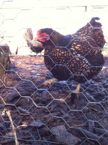
Crossing the road we admired the hens at the side of the path, before continuing on the riverside path, and over a field to emerge yet again on the A57, only this time not so lucky, having to wait a few minutes for a break in the traffic to cross.
Once across, we walked up the field and followed “park wall” to return to Todwick on Manor Drive.
At just over 6.5 miles with easy walking, all agreed that it had been an enjoyable walk, particularly as the club Jester was absent with a cold.
Terry Calladine
24th January 2015
Hardwick Hall – Spencer’s Wood – Norwood – Pear Tree Lane – Teversal Trail – Silverhill Wood Country Park – Miner’s Memorial – Tibshelf – Hardwick Inn
Twenty enthusiastic walkers were rewarded with a sunny, but crisp, January morning for our two Counties walk.
Starting in Derbyshire at the NT Hardwick Hall car park, a pleasant stroll took us through Lady Spencer’s Wood and out of the park to the Nottinghamshire hamlet of Norwood. We then took a field path which with the sun thawing the earlier frost had been made very sticky underfoot, but fortunately we soon joined the grassy track of Pear Tree Lane.
As the track turned into a surfaced lane, we descended to the Teversal Trail for a short distance before entering Silverhill Wood Country Park. This was the former Silverhill Colliery which during the miners’ strike was one of the collieries which continued to work, and was featured on many news reports.
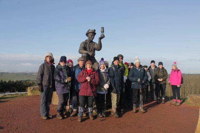
A short climb took us to the claimed highest point in Nottinghamshire, although at just 670 feet above sea level this is more of a mole hill than a mountain. This is a manmade hill being the former pit tip, with an extra 15 feet of peak being added during the landscaping. The high point allows for panoramic views over five counties, with Lincoln Cathedral, 32 miles away being seen on a clear day. The peak is also home to a very impressive bronze statue of a kneeling coal miner with a Davy lamp testing for gas. The statue is “A tribute to the Miners of the Nottinghamshire coalfields, commemorating coal mining at the 85 Nottinghamshire collieries” all now closed.


Dropping down from Silverhill, we arrived at the former rail station at Teversal where we stopped for our refreshment break.
Fully refreshed, our route was along the Tibshelf trail for 1 mile before dropping down to field paths through which it was pleasing to note that the difficult old wood stiles had recently been replace with steel kissing gates, well done Nottinghamshire CC!
After crossing a road, further fields were crossed, however now back in Derbyshire the old wood stiles were still in place. The crossing of which caused some difficulties, and much laughter from the on looking walkers.
We soon emerged at the village of Stanley, with easy minor road walking back to the Hardwick Inn entrance to the park. At this stage we had an unofficial change of leader who decided that rather than the direct route back to the car park, we would climb the grass hill up to the old hall.
We all arrived back at the car park with rosy cheeks, and tired legs having walked just over 7 miles with the late addition to our route.
Thanks to Mark for all the photographs he took during the walk.
Terry Calladine
11th January 2015
Langold Country Park – Dyscarr Wood – Langold Lake
In a welcome respite from the early January wind and rain, twenty-four members blew the cobwebs away with a short 5-mile walk.

We started at Langold Country Park, through Dyscarr Wood, across open, muddy fields and back through the woods to the park, finishing with a circuit around Langold Lake. Some members took advantage of the excellent value Sunday lunch in nearby Andy’s Café.
Rosemary Chambers
7th January 2015 – The Boring Prison Fence Walk
Hollingwood Hub – Killamarsh – Barrow Hill Round House – River Rother
Unlucky for some thirteen Ramblers, including three guests, turned up for this unexciting walk.
The walk started from the Hollingwood Hub which is the home of the Chesterfield Canal Trust and luckily the car park was open. With the weather forecast being for rain around 1 pm we were off bang at 10 am heading down the canal towards Killamarsh for ¾ mile before taking a footpath to the left and over the river Rother which is running quite fast at the moment. This is where the walk got its name as the path is fenced in mostly on both sides as you walk through the old Works areas, the buildings have gone and only a disused railway line remains. A paddle through a darkish tunnel with the railway above was no problem for our intrepid walkers. Following the railway brought us into Barrow Hill and down to the Barrow Hill Roundhouse which is the old railway works well worth a visit.


After a short coffee stop we set off along the main road and onto a footpath which follows the main railway line then goes through the woods and onto the River Rother alternative footpath, this was a bit muddy but not too bad. We then picked up a track that took us back to the canal and then just a steady stroll back to the start, five miles in an area that most Ramblers had not been before. The timing was spot on as it started raining just after we got back. The Hub also has Nona’s Coffee Shop and I think the two Sues gave it a try. Thanks to all the Ramblers who came and a Happy New Year to the rest.
Mad Mick & Syl