Todwick Ramblers Club Walks: 2016
30th December 2016
West Stockwith – River Trent – River Idle – Old Pumping Station – Marina
Over the Christmas Holiday T Rubble and Mad Mick put on an extra walk from West Stockwith on the River Trent which is the start of the Chesterfield Canal. The weather was murky but brightened up as we progressed. We followed the River Idle for 1.5 miles before crossing over at the old Pumping station. I had downloaded three Geocaches and to our surprise we had a Geocache expert with us who found the first and second one with ease.
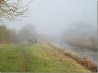
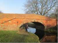
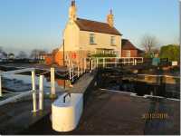
We joined the canal for a while then headed off on a small lane, and found the wall of a derelict house for a sandwich stop. After crossing some fields bordering a large fuel storage area from the Second World War we again joined the canal. At one point we had a problem with Ann H and she had to send a SOS. The marina and large lock are worth a visit, unfortunately we did not see any barges attempt to enter the lock which I believe is testing.
For Ramblers that could not make the walk is 7 miles all flat and is well worth the run out. Thanks to the Ramblers that came on short notice – any complaints see T Rubble.
Unfortunately we will not see Neil on anymore walks as he has taken up full-time Geocaching.
Keith Eyre
27th December 2016
Todwick – Wales – Manor Road – Church Street – Fields – Todwick
On Tuesday, 27th December 2016 the day dawned over a Christmas panorama with clear blue skies and the sun shining down on fields and hedges that had been lightly dusted with frost overnight. It was this scene that presented itself to 21 ramblers, who, full of good spirits and Christmas cheer, met up on The Pastures at 10.30 am to enjoy a 4-mile circular stroll along the pleasant lanes and footpaths that link Todwick and Wales. Initially the group’s walking pace was somewhat slower than normal. This may have been due to an excessive indulgence in food and drink over the Christmas festivities. After about an hour the group marginally quickened its pace, though there was still ample time to enjoy the views and later the Christmas decorations as we sauntered along Manor Road and Church Street in Wales.
On leaving Wales behind we halted for a brief coffee stop where mince pies and delicious ‘chocolatey stickies’ were much in evidence and shared around.
As the sun continued to shine down on the group, many of the ramblers started to remove layers of unnecessary clothing to compensate for the unforeseen spring-like weather, which was a delightful bonus for anyone enjoying the countryside that day.
However, this weather phenomenon created a bit of a downside regarding the field paths that lead back into Todwick. Unfortunately, the paths had become very sticky due to surface ice on the ground quickly melting and all too soon walking boots that had maintained their pristine conditions up to this point were soon covered in sticky mud. This put a severe dent into the assurances given by the walk leader at the start of the ramble that any boot cleaning chores at the end of the day would be minimal.
Needless to say this Christmas stroll had been enjoyed by everybody, and as we separated to go our different ways home we were looking forward to welcoming the New Year, and with it the club’s next programme of rambles.
Jim Tompkin, walk leader
18th December 2016
Southwell Trail – Lower Hexgreave – Hexgreave Deer Park – Belle Eau Park – Eakring Brail Wood – Bilsthorpe Pit – Bilsthorpe – Southwell Trail
Our walk began at the car park on the Southwell Trail on the outskirts of the village of Farnsfield. Sixteen members took part on what turned out to be quite a pleasant day.
Initially we headed east for a mile along the Southwell Trail on an excellent path with Farnsfield on our south side and open fields to the north. We then turned north across cultivated fields to Lower Hexgreave Farm over three stiles and on to Hexgreave deer park. Here we were lucky enough to see a large herd of red deer.
We then continued north across the A617 and through a small industrial estate called Belle Eau Park. The hard work of the day began here as we climbed steadily uphill to the corner of Eakring Brail Wood. A wide rough road was taken directly through the wood as we began our return. At the eastern end of the wood we took a path that took us through the old Bilsthorpe Pit site where evidence of gas collection was evident. We walked through Bilsthorpe to join the northern end of the Southwell Trail where we stopped for a lunch break.
The Southwell Trail has been created on a disused railway line and is an excellent path and we followed this directly back to our cars having covered a distance of approximately 8 miles.
Neil Hawksworth, walk leader
8th December 2016
Hardwick Hall – Arbella’s Bower – Row Ponds – Hardwick Hall
On a wet morning, 6 members met in the car park at Hardwick Hall on 8th December 2016. Fortunately, the rain stopped just as the walk was about to commence and never returned.
The walk took us through woodland and fields in the parkland. A short stop was made at Arbella’s Bower to discuss the life of Arbella Stuart who lived for many years at Hardwick Hall with her grandmother, Bess of Hardwick. A further coffee stop was made at the Row Ponds where I once saw a snake whilst walking in the parkland some years ago. The route then took us back across fields and a tarmaced road to the car park, a distance of approximately 3.5 miles.


A very pleasant lunch was then taken in the Great Barn restaurant before continuing to the Hall where we all enjoyed viewing the wonderful floral displays and decorations. Fun was had trying to “find” the items representing the 12 days of Christmas within the Hall.
Many thanks to the ramblers who attended this enjoyable visit.
Ernest and Judy Wraith.
27th November 2016
Budby South Forest – Hangman woods – Birklands – Sherwood Forest – Major Oak
Budby South Forest was the starting point for the 23 walkers on our late November ramble on a lovely dry and bright autumn day.
This former MOD tank training area of heathland forms half of the Sherwood Forest National Nature Reserve and provides a network of easy paths for the walker. It is one of the few areas of open access land in Nottinghamshire, home to many protected birds, rare insects, and Sherwood’s last herd of wild red deer. The area is now managed by the RSPB on a long-term lease for the owner Thoresby Estates.
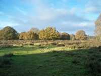
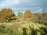
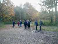
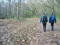
A walk of about 2 miles along grassy tracks, made in the past by tank movements, took us into Hangman woods were we took our coffee stop.
Once refreshed we continued along the tree lined Hangmans Lane to reach the more popular areas of Birklands, better known as part of Sherwood Forest. A number of forest paths through sweet chestnut and beech trees took us to our lunch stop at the Major Oak. From the famous tree a short walk soon took us back onto the heathland and to our starting point.
A delightful walk of just under 6 miles was enjoyed by all.
Terry Calladine
6th November 2016
Shire Brook – Linleybank Meadows – Beighton Marsh – Woodhouse Junction – Victorian Bath House of Birley Spa – Silkstone Ravine – Shire Brook
On Sunday, 6 November 2016, twenty-three members braved the elements for a walk exploring the many interesting features of the Shirebrook Valley Nature Reserve. Firstly heading east from the car park and going down the main section of the valley, we followed the course of the Shire Brook which runs from Gleadless to join the river Rother near Beighton. The brook is so named because it defined for 900 years the boundary between Yorkshire and Derbyshire. Crossing Linleybank Meadows, a great example of nature conservation on a former colliery tip, we entered the rare vestige of wetland at Beighton Marsh before heading back to our start point via Woodhouse Junction and the northern slopes above the valley.
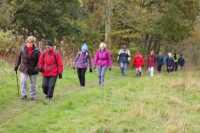
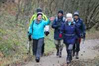
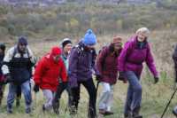
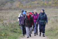
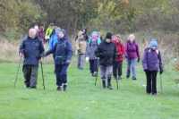

Lunch was taken in the warmth of the Visitor Centre where tea, biscuits and toilets were available. Thanks must go to the Shirebrook Valley Heritage Group who had opened the centre especially for us. Walkers were able to learn more about the fascinating history and wildlife of the valley by looking at the exhibition displays and reading the leaflets and guides there.
After lunch and thankfully now in dry conditions, the ramblers set off on the second part of the walk. The focus was now on the cultural and industrial history of the valley as we explored the remnants of dams and water mills formerly used in the making of sickles and scythes. We also visited the listed Victorian Bath House of Birley Spa and its now sorry-looking “pleasure grounds” before continuing to the top of the Silkstone Ravine, a rare remnant of lowland heath, and the site of a military jet aircraft crash in 1955. We ended the walk by descending through the attractive wooded ravine and back into the main part of the valley, crossing the Shire Brook for a final time and reaching the car park by walking along a short stretch of a disused colliery railway line now part of the Trans Pennine Trail.
Ken Whetter
21st October 2016
Lodge Moor – Rivelin Dams – Redmires Reservoirs
It was a cool but clear morning when 14 intrepid walkers met in the car park next to The Sportsman pub on Redmires Road. We were interested to watch three powered paragliders take off from the adjacent field, and thought it must be cold up above us! We soon warmed up when we started walking, down a steep and at times rocky path to Rivelin Dam. It was lovely walking through the woods with many trees showing autumnal colours.
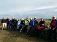
After an easy stretch of walking alongside the dams we climbed up Head Stone Bank, at the top there were spectacular views over the surrounding countryside and back towards Sheffield. We stopped for lunch on a bridge over the conduit and then followed the conduit to Redmires Reservoirs. We walked to the end of the road then around the three reservoirs, along a good path besides a wood and back to our cars.
Good weather helped to make this a lovely walk of just over six and a half miles, in an area new to many of our walkers.
Marion Brassington
1st October 2016
Curbar Gap – Wellington Monument – Birchen Edge – Robin Hood PH – Gardoms Edge – Curbar Gap
8 ramblers met at the National Trust car park at Curbar Gap on Saturday, 1st October 2016 for this journey round some of the millstone grit edges of Derbyshire. Five minutes into the walk we were standing on Baslow Edge looking down on a valley full of mist.
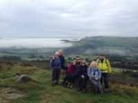
We walked along the edge to Wellington Monument, said to have been erected to commemorate a visit by the Duke of Wellington to the area, then passed through a herd of Highland Cattle with calves. Their horns must have been 2 metres across. Luckily they were friendly.
We reached Birchen Edge where the Nelson Monument, a tribute to his victory at Trafalgar, stands alongside 3 large gritstone boulders called VICTORY, DEFIANCE and ROYAL SOVERIN (spelling obviously not a strong point in Derbyshire). After lunch outside the Robin Hood we climbed to Gardoms Edge, named after a Chatsworth blacksmith, and site of extensive archaeological Bronze Age finds. Finally down into the valley and a steep climb back up to the Wellington Monument and past the Eagle Stone back to the start.
Nige and Jude Singleton
11th September 2016 – Family and Friends Charity Walk in Sherwood Forest
Sherwood Forest Visitor Centre – Major Oak – Birklands Ramble
On a beautiful early autumn morning on the 11th September, 23 people assembled in the car park at Sherwood Forest for the first Todwick Ramblers charity walk. Starting from the Visitor Centre we first made our way to the Major Oak estimated to be close to 1000 years old. Many years ago it was possible to get close to the tree but this was stopped sometime ago because of the damage being done to the tree’s root system. Our route continued mainly on the Birklands Ramble marked by red posts.
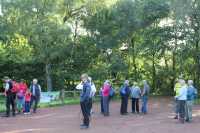
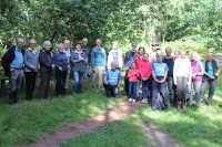
After passing through some beautiful woodland we made a coffee stop where the walk raffle was drawn. The prize winners were:
- Brenda Palmer, bottle of Prosecco
- Jean Knowles, biscuits
- Jenny Hudson, a box of chocolates
Suitably refreshed the walk continued along the Birklands Ramble passing an area where we were hoping to see lots of birds coming to feed from strategically placed bird feeders. However, very few were on view probably because of the noise from our group! Close to the end of the walk we passed through the picnic area before making our way back to the car park. A walk length of approximately 4 miles. Some of the ramblers then decided to take Sunday lunch in the restaurant at the Visitor Centre.
A total of £215 was collected for the charity Diabetes UK. An outstanding amount from the Todwick Ramblers and their family and friends. Many thanks to all who contributed including those who donated even when not able to come on the walk.
Ernest and Judy Wraith
4th September 2016
Ogston Reservoir – South Hill Lane – Ford – Higham – Brackenfield – Woolley – Ogston Reservoir
The rolling Derbyshire farmlands of the upper Amber Valley, thankfully still ignored by the crowds that flock to the Peak District, was the venue for our early September walk. Our starting point was Ogston Reservoir, constructed in 1958 to provide water for the NCB carbonisation plant at Wingerworth on the southern side of Chesterfield. The plant is now closed, and this blot on the landscape together with its obnoxious smells has long since disappeared. The reservoir now provides water for the local area, but is best known for the location were Ellen MacArthur, the long distance yachtswoman, trained, as well as being a SSSI.
Starting our walk along South Hill Lane, which running parallel and slightly elevated from the reservoir gave splendid views across the water to the hills on the opposite bank. Passing through the hamlet of Ford, we joined the rough track of Ogston Lane and gradually climbed to emerge in the village of Higham, stopping briefly on the way to admire the view down the valley to Crich Stand on the far hill.
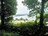
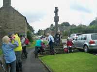
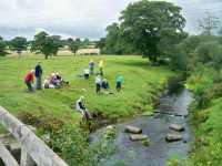
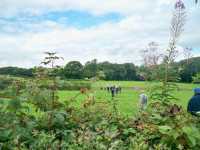
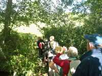
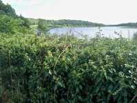
The village of Higham, laying just off the busy A61, on the old Roman road retains many of its original stone cottages and a cross on stone steps showing it was once a market town. Following a short rest, we continued through the village to join field paths down to cross over the River Amber, on the banks of which we stopped for our picnic lunch.
Crossing further fields we reached the next village of Brackenfield. This spread out village has a large green and woods more reminiscence of a New Forest village than one in Derbyshire. Our route was along the old drive to Ogston Hall, which soon became a path crossing a number of small fields with some tight squeezer stiles. Rejoining the road at the hamlet of Woolley, most of which now lies beneath the waters of the reservoir, we returned to our start point.
Although the walk was commenced in light rain, the sky soon cleared with glimpses of the sun to enhance the enjoyment of the 14 walkers on this 6.5 mile walk.
Terry Calladine
21st August 2016
Todwick – Aston – Common Farm – Hardwick Lane Farm – Aston
On Sunday, 21st August 2016 a small group met at Todwick to walk to Aston for a barbecue at a club member’s house. The walk took us past Common Farm, crossing the A57 to Hardwick Lane Farm and over the M1 towards the radio mast and trig point and on to Aston. There we met with other members and enjoyed a fabulous meal with a variety of fish to start followed by BBQ meats (with not a trace of carbon in sight) and multiple sweets and cheeses, all washed down with wines and soft drinks. Brilliant.
Nigel Singleton
14th August 2016
Hassop Station – Monsal Trail – River Wye – Bakewell
18 keen ramblers descended on Hassop Station on an overcast but very mild Sunday. We joined the Monsal Trail for a short but very pretty walk, leaving the trail and up over farmland which led us down along the River Wye.
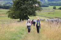
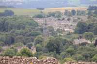
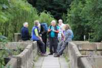
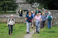
Following the rivers’ banks down into Bakewell, up through fields and rejoining the Monsal Trail for a mile back to our original start where 16 of us enjoyed lunch and a catch up. The walk was a 4-mile circular.
Caroline Green
5th August 2016
Longshaw House – Burbage Brook – Padley Gorge – Nether Padley – Padley – Longshaw House
The last time we attempted this Longshaw Estate walk was in November last year, the weather was awful so a repeat was promised for the following Summer. Thankfully the day was perfect for walking, sunny with a slight breeze to keep us cool.
19 Todwick Ramblers met at the National Trust Longshaw House car-park. The route took us alongside Burbage Brook, always a favourite kids’ play-spot in the Summer holidays, even at 10.15 am it was quite busy. We then walked down through Padley Gorge with the sound of the brook tumbling down alongside us. On reaching Nether Padley we turned right up the Derwent valley. Here the ledge outside Padley Chapel provided a comfortable spot for tea and snacks.
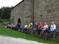
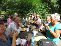
We continued up the valley through ancient woodland eventually reaching the edge of the river. The walk continued back alongside the river, through more pleasant woodland and then back through sheep pasture to Padley and onwards to the Grindleford Station Cafe. Traditional walker’s food was enjoyed – mugs of tea, bacon sarnis, chip butties, cake.
Well refreshed we made our way back on the other side of Burbage Brook through Padley Wood, a pause by the ice-cream van then back along the Estate footpaths to Longshaw House. A good challenging walk of about 7 miles.
Brian Chambers
28th July 2016
Drakeholes – Chesterfield Canal (Cuckoo Way) – Grindley Lock – Clayworth – Clayworth Bridge – Drakeholes
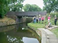
The Chesterfield Canal towpath, known as The Cuckoo Way, provides many opportunities for varied and interesting walks. Our late July 2016 walk utilised the large bend in the canal which contours the hill side of Gindley on the Hill.
Meeting at Drakeholes on a dry and bright morning, 10 members set out along the towpath determined to complete the walk before the forecast afternoon rain. After less than an hour of easy walking we reached our coffee stop at Gindley Lock with the picturesque lock-keeper’s cottage, now restored and a private residence.
At this point we left the canal for the only climb on the walk up to Grindley on the Hill village, although this was a gentle incline compared with walking in the Peak District.
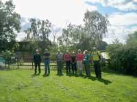
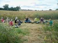
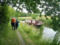
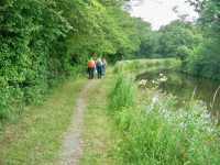
Crossing the busy Bawtry to Gainsbrough road and a few fields we arrived at our lunch stop. Although a little early, with the rain still not commended and a nice grassy area to sit on, it was agreed that lunch would be taken.
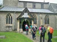
Fields of ripe barley, oil seed rape and broad beans took us to Clayworth, emerging at the side of the church of St Peter. A visit was made inside the church to view the Traquair Murals. These were painted by the Scottish artist Phoebe Traquair in 1905 and renovated to their original splendour during 1966 by Elizabeth Hirst.
Rejoining the canal at Clayworth Bridge we again walked along the Cuckoo Way back to Drakeholes, unfortunately being caught in a sharp rain shower just before getting back to our cars.
Terry Calladine
25th June 2016
Aston Fishery complex – Nickerwood Farm – Low Laithes Farm – Upper Common Farm – Todwick Common Farm – Red Lion Hotel
On 25 June 2016 the weather forecasters were giving assurances that the evening would be warm with sunny spells.
This information persuaded 10 members to don summery walking attire, leave their wet weather gear at home, and set off by bus to enjoy a linear evening ramble of approximately 5.5 miles that would commence at Aston Church and finish in Todwick village.
The proposed route promised a variety of landscapes and vistas which started with a watery experience as we meandered around the ponds of the Aston Fishery complex.
Soon we were walking up a steady incline that would take us to a predominantly headland footpath that follows the curtilage of Nickerwood Farm. Unfortunately we found that the rape seed crop in the field had grown to such a height that the line of the footpath had become virtually obstructed, forcing the party to walk carefully and slowly to avoid any accidents. It was with a sense of relief that we all arrived at a stile that enabled us to access a motorway bridge from where we could resume our normal walking pace.
The rest of the ramble proved to be an enjoyable experience as we followed the footpaths that had been kept clear around Low Laithes Farm, Upper Common Farm and Todwick Common Farm.
Due to the loss of time incurred by our problems with the oil seed rape, half of the party decided to return to Todwick via a shorter route. The remaining ramblers continued to follow the original plan, whilst keeping an eye on a large black cloud that had appeared overhead.
Unfortunately, our worst fears were soon to be realised as large droplets of rain started to fall suggesting a cloudburst was imminent. However, by sheer coincidence the group happened to be passing by the Red Lion Hotel at the same time as the heavens opened, enabling the party to take shelter within the pub, where we enjoyed its hospitality until the storm had abated. Because of this further delay it was decided that the remainder of the route be abandoned, and a quick return to Todwick village would be the most expedient thing to do.
Jim Thompkin
7th – 9th June 2016
3 walks: Buckden in Upper Wharfedale and Hubberholme; Burnsall to Kettlewell; Grassington and Kettlewell
Between Tuesday 7th and Thursday 9th June 2016, twenty members of the Todwick Ramblers enjoyed three days of walking in the beautiful Yorkshire Dales. All three walks included parts of the Dales Way, a 78-mile long distance trail.
Staying at Grassington, the group’s first walk was a circular route from Buckden in Upper Wharfedale, involving a long initial climb and then a fairly level route, contouring the valley-head to descend to the small hamlet of Hubberholme and a riverside walk back to the car park. The hot and humid weather meant that several stops were needed, the last one to shelter from a short but heavy rain shower.
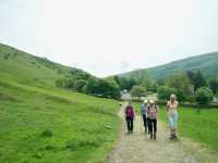
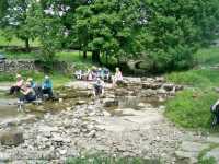
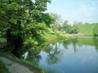
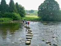
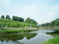
Having thrashed out the transport arrangements over a few drinks the night before, the second day’s walk was a 10-mile linear route from Burnsall to Kettlewell. The first stage of the walk from the pretty village of Burnsall to Grassington followed the popular riverside path and 20 members enjoyed warm and sunny conditions for this. Arriving at Grassington for an early lunch stop, the sensible element of the group then concluded their walking and spent the rest of the afternoon sampling the many facilities of the town or just ambling back to Burnsall. The hardier, or perhaps more reckless, half of the walking party however, set off on the second stage of the route over the high open ground between Grassington and Kettlewell, a distance of around six and a half miles. Initially sunny, the weather soon deteriorated and rain soon added to the challenge but detracted little from the pleasure of the long-distance views. The whole group assembled for dinner at The Forresters in Grassington that evening to share the experiences of day and to thank the event’s organiser, Ken Whetter.
The final day’s walk was a 6-mile circular in the Bolton Abbey estate, from the nature reserve of Strid Wood to the dramatic ruins of Bolton Priory, following both banks of the Wharfe. On probably the hottest day of the event, the group needed no persuasion to indulge in a few ice creams, teas and soft drinks.
Ken Whetter
1st June 2016
Boughton Pumping Station – Boughton Brake Wood – Walesby Common – Walesby – Kirton – Boughton Pumping Station
10 walkers met at the pumping station, a lovely building but now just offices, for this 6-mile circular walk. The first part of the walk was through Boughton Brake, a fine area of woodland criss-crossed with paths, and then around the edge of Walesby Common before a right turn towards Walesby.
We stopped a while to watch the free-range chickens at a farm and pondered the life of these birds, with acres to roam in, compared to the life of the standard supermarket bird. Makes you think.
After a coffee stop at the abandoned railway, built in 1961 for the new Bevercotes Colliery, the world’s first “push button” fully automated mine, there followed a narrow path through wet undergrowth then a lunch stop in Walesby. On to Kirton via field paths and back to the start point at the old pumping station.
A good walk in an area new to us all. Sadly, a cold and windy June day.
Nigel and Jude Singleton
25th May 2016
Low Bradfield – Agden Reservoir – Low Bradfield – Dam Flask – Low Bradfield
8 Todwick walkers and a dog met in the car park at Low Bradfield, to be joined by two ladies who had arrived after their own walking group had left.
It was an overcast day but there were only a few spots of rain, ideal for walking. The walk was in two distinct parts, the first being around Agden reservoir, a path which required concentration, but had lovely views across the water. The spring green of the trees with late bluebells dotted about made it particularly beautiful.
Back in Low Bradfield we had the luxury of toilets, and not one but two cafés with plenty of seating, people choose where they wished to go and we met up just before 12 noon to walk around Damflask. This was an easier path and we made good time, getting back before the rain started in earnest.
It was a very pleasant walk in a delightful area.
Marion Brassington
13th May 2016
Trans Pennine Trail Car Park by Cote Green Farm Wortley – Don River – Green Moor – Ivy Millennium Green –The Old Mill – Romticle viaduct – Wortley Top Forge
Under an overcast sky 13 ramblers gathered in the Trans Pennine Trail Car Park by Cote Green Farm Wortley to begin our exploration of a beautiful section of the Upper Don Valley. No sooner than we had got our boots on, out came the sun, so much for Friday the thirteenth being unlucky. We set off down the lane to make our first crossing of the Don. Three crossing options were available, the ford, the stepping stones or the foot bridge. Needless to say no one chose the ford, but the other two options were split 50:50. Our route then followed an ancient track up the thickly wooded valley side then out into open fields to eventually join the road into the village of Green Moor. Here we had our first break, on Ivy Millennium Green from where panoramic views of the Don Valley and the countryside beyond were to be had.
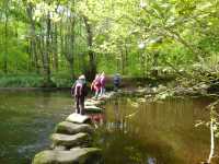
Leaving Green Moor by steep paths and farm tracks we crossed the Don for the second time by a foot bridge to reach a small road that runs by the river. Taking this road we arrived at The Old Mill, built in 1645 as a wire mill, and now a beautifully restored house complete with fake water wheel. The track alongside the Mill Dam led to a riverside path which passed under Romticle viaduct and then up onto the disused railway track, now part of the Trans Pennine Trail. After a few yards we passed thought a 1000 ft. tunnel accompanied by two horses, several cyclists and a young lady with a push chair.
Exiting the tunnel we continued on the railway track, passing a group of Duke of Edinburgh Award Scheme hopefuls who appeared to be lost, to reach our lunch stop. After lunch we left the railway track and after several attempts found the path leading back to the river bank. Following the path through beech woods we saw on the opposite side Wortley Top Forge and its associated dams. Leaving the river for the last time we crossed the fields and arrived back at the car park. The 4.5 mile walk took 4 hours at a leisurely pace. Many thanks from Anne and myself to those ramblers who joined us on this walk.
David Warburton
7th May 2016
South Anston – Anston Stones Wood – Lindrick Dale – Chesterfield Canal – Old Spring Wood – Hawkswood – Anston
On a bright and sunny spring morning on Saturday, 7 May 2016, twenty ramblers met at South Anston for a six-mile leisurely walk. This took us through Anston Stones Wood, down Lindrick Dale and across farmland to the Chesterfield Canal.
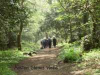
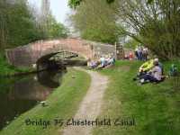
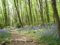
After a welcome snack break and sunbathe by the canal, we detoured through Old Spring Wood and were all delighted by the magnificent carpet of bluebells, a real joy to behold. We returned to the canal via Hawkswood (and more bluebells), then along the canal and a steady climb back to Anston.
The highlight of the walk was the profusion of wild flowers... cowslips, early purple orchids, wild garlic, violets and many others in Anston Stones Wood, and of course the bluebells near the canal... and not forgetting the welcome sunshine! The walk was good.
Rosemary Chambers
24th April 2016
Revolution House Museum Old Whittington – Handleys – Grasscroft Wood – Manor Farm – South View Farm near Nether Handley – New Whittington – River Rother – Brearley Park – Revolution House
On Sunday 24 April 2016 ten ramblers decided to ignore the poor weather forecast and assembled outside the Revolution House Museum Old Whittington.
Fortunately the weather conditions turned out to be ideal for walking as we set off to follow a 6.5-mile circular route that traversed around a countryside district known as the Handleys. A name derived from the three hamlets of Middle, West, and Nether Handley.
With the bells of St Bartholemew’s Church ringing out a cheerful medley of chimes we tackled our first gradient of the day, which turned out to be the 180 foot climb to the edge of Grasscroft Wood. Here we paused a while to rest and enjoy the panoramic view of Chesterfield revealed below us.
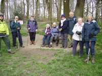
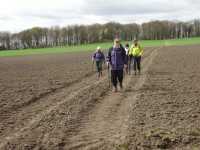
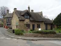
Continuing on a Northerly direction we traversed a path line through fields and along a minor lane to reach Manor Farm on the outskirts of West Handley. Passing through the Farm we used a ridge path that opened out to give excellent views, once again, over Chesterfield and beyond. On leaving the ridge our route crossed over a series of undulating fields to access a green lane at South View Farm near Nether Handley. This we followed to its termination at a minor road to reach the outskirts of New Whittington. Here our route became more urban, as we threaded our way through arable fields to reach and follow the banks of the River Rother.
The last section of this circular route was completed by walking through Brearley Park before returning via woodlands to Revolution House.
Jim Tompkin
10th April 2016
Todwick – Kiveton Hall Farm – Kiveton Park Station – Chesterfield Canal – Tommy Flocktons – Kiveton Woodlands – Wales Church – Storth Lane
Eighteen members set off at 10.00 a.m. on a lovely sunny morning after meeting at Todwick Newsagents for our second Sunday in the month local walk. After a cold frosty night conditions were thankfully much less hazardous than had been anticipated after the pre-walk earlier in the week following very heavy rain. We walked along Kiveton Lane towards Kiveton Hall Farm where we crossed the road and took field footpaths to bring us out in the old limestone quarry opposite Kiveton Park Station from where the stone for the Houses of Parliament was quarried. We crossed the road and the railway level crossing and turned right to take the footpath westwards along the south side of the Chesterfield Canal. We soon came to a magnificent waterfall which originally was the water supply for the canal’s eastern locks and comes from Harthill ponds via a stream past the pit and through Tommy Flockton’s to Broad Dyke sluice which ends at this waterfall on the north side of the canal. This is also a winding hole here for canal barges turning round. We past the bricked-up end of the Norwood Tunnel which collapsed on 16 October 1907 resulting in its closure, before crossing the marshy grazing meadow known as Tommy Flocktons (official name Pennyholme Marsh), which now has a much improved footpath. Apparently Tommy Flockton was a surveyor who lived in the area in about 1880.
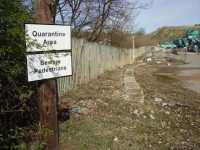
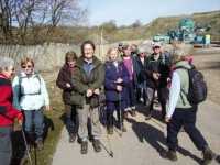
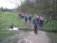
After crossing Hard Lane and entering Kiveton Waters we had our first coffee stop before we were to take in some of the many footpaths which have been created on and around the reclaimed Kiveton Colliery slag heap, the site of the old Kiveton Pit Tip. After the colliery closed in 1994 work started in 2004 to create a nature reserve and recreational area for the community by landscaping and planting the area. The birds were singing including one of our earliest migrant warblers and a harbinger of spring, the Chiffchaff. This bird is quite easy to recognise by its song as it does tell you its name, if you get your ear in so to speak. After walking around the periphery of the area we took one of the steep uphill paths to the ‘pit top’ area where the cowslips were beginning to come into flower, another lovely spring sight and from here we had magnificent views of the surrounding countryside. On taking the steep downhill path from the ‘pit top’, part way we found a sheltered spot to have our main lunch break, still with the sun shining.
We then continued to the bottom of the ‘pit top’ to ford a stream which in crossing thankfully we did not need the anticipated snorkels. We walked along the periphery of the area for a little way before turning towards the houses of Kiveton Park. We turned left following a signed footpath along an arable field before crossing over some grazing meadows with horses to eventually arrive at the top of Church Street at Wales. The walk then took tarmacked footpaths past the church into Wales Square, along Manor Road before turning right into Storth Lane and to its end, here turning left onto the bridle path past Wales High School and over the railway bridge to continue on the well trodden path across ‘The Meadows’ (the name by which I have always known it), and back to Todwick at 1.30 p.m. a distance of almost exactly seven miles. All in all a very pleasant morning walk in the welcome spring sunshine.
Sue Parker
20th March 2016
Whitwell Woods – Clowne – Southgate House / Van Dyke Hotel – Harlesthorpe – Whitwell
On 20 March 2016, twenty-eight members of the Todwick Ramblers enjoyed a walk around Whitwell Common. In glorious sunshine that was as welcome as it was unexpected, the group set off from the large lay-by on the A619 into the splendid and large Whitwell Woods. The Woods, part of the Welbeck Estate, is well known for its nature conservation and archaeological interests and is managed by the Forestry Commission whose written permission was needed for the group’s walk. Emerging from the Woods after a mile or so, the route continued on quiet country roads and farm tracks heading towards Clowne.
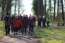
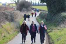
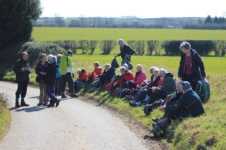
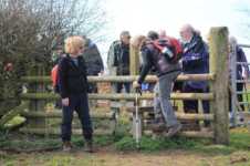
A main feature of this walk was Southgate House, or the Van Dyke Hotel, as it is now known. This Georgian country house has a colourful history with links to grand families in Derbyshire and in the North West of England and was even the site of a POW camp in World War Two. Many of the farmsteads that the group passed by on the walk were once part of the Southgate estate. Skirting the angling lakes at Harlesthorpe, the walk continued along lanes on the outskirts of Clowne and then across the Common back to the village of Whitwell with its interesting church which is listed among Simon Jenkins’ book on the 1000 best churches. The final short section of the walk followed a steep lane leading back to the lay-by where our cars were parked.
Ken Whetter
9th March 2016
Crowgate South Anston – Chesterfield Canal – Hawks Wood – Old Spring Wood – Lindrick Dale – A57 – Anston Stones Wood – A57
On a very wet morning on 9 March 2016 seven intrepid ramblers met at the car park on Crowgate, South Anston for a local predominantly woodland walk. The weather forecast was for continuous rain throughout the walk and this proved to be the case.
The route commenced through part of South Anston before setting out across the fields down to the Chesterfield canal. After following the canal for a short period of time we entered Hawks Wood the first of three woods we would pass through. At the top of the wood the village of Thorpe Salvin could be seen with the old and new halls in view. Leaving Hawks Wood we entered Old Spring Wood which eventually took us back down to the canal where a short stop was made on the bridge over the canal for a coffee break. Crossing back over the railway took us over a field and then into Lindrick Dale before crossing the A57 to enter the third wood, Anston Stones Wood where a lunch stop was made. Suitably refreshed our hardy group continued through the wood before crossing back over the A57 to enter the village of South Anston and back to the starting point of the walk.
Although the weather and underfoot conditions had been poor along the walk it was still an enjoyable outing and it would be interesting to repeat the walk at later date when weather conditions are better. The length was 5.7 miles. Both Judy and I would like to thank the people who turned out for this ramble.
Ernest & Judy
28th February 2016
Teversal Visitors Centre – Silverhill Trail – Stanton Hill Village – Brierley Hill Forest Park – Greenwood Community Woodlands – Brierley Branch Trail – Teversal car park
Our end of February walk again centred on the extensive system of walking trails in the former mining area of North Nottinghamshire and South East Derbyshire. These old mineral track beds which once connected the mines with railways now provide the walker with tranquil and varied walks when used in conjunction with the many field paths.
On a cool but bright morning the 22 members met at the Teversal Visitors Centre to start an easy 5 mile walk.
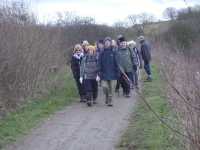
After a short stroll on the Silverhill Trail, field paths were taken to reach Stanton Hill Village and then to enter Brierley Hill Forest Park. The Forest Park was created in 1992 from a combination of the old Sutton Colliery and farm land, and is now part of the Greenwood Community Woodlands comprising of an area of over 250 acres, making it the largest Community Woodlands in the UK. Shortly we reached our refreshment stop at the Brierley Forest Visitors centre, a number of members indulging in the bacon and sausage butties on offer.
Fully refreshed, we continued in the park up to Hardwick view, stopping to admire the view of the hall and also the Derbyshire hills in the distance.
Our return route was along yet another trail, The Brierley Branch and field paths to arrive back at Teversal car park.
Terry Calladine
24th January 2016
Newstead Abbey – Papplewick – Linby – Linby Docks – Newstead Abbey
Once the home of poet Byron, Newstead Abbey was the starting point for our latest walk. Originally founded by Henry II, the Abbey formed an impressive background as the 28 members set forth on a mild and dry day for an easy 6-mile ramble around the Nottinghamshire countryside.
Passing through the park gates a wide grass lane soon took us to the village of Papplewick, best known for its water pumping station, although this is a distance from the village. Our first stop was taken close to the village church, which is reputably the resting place of Alan-a-Dale, one of Robin Hood’s Merry Men.
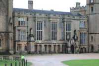
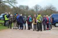
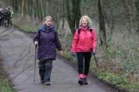
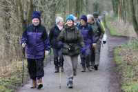
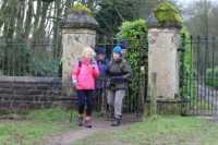
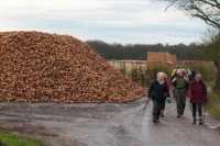
Field paths and a short road walk took us to the second delightful village on our route of Linby. The main feature of this village is the twin rivers which run down each side of the main street and known as Linby Docks, despite being no wider than 5 feet, and less than 6-inch deep in water. During the war, German propaganda reported that Linby Docks had been successfully bombed with large losses sustained by the Royal Navy!
Our return to Newstead Abbey was along the Linby Trail, yet another former disused mineral rail line, which are so useful to walkers.
Thanks to Mark for all the photographs he took during the walk, some of the expressions on the faces of the walkers, unaware that their photos were being taken being a source of much amusement!
Terry Calladine
10th January 2016
On Sunday, 10th January 2016, 28 ramblers congregated by the shops on The Pastures to take part in the first ramble of the Club’s 2016 programme. It was to be a 9 km circular ramble around a broad segment of the countryside that surrounds Todwick. We considered ourselves fortunate that the weather had briefly changed for the better and was providing us with the ideal conditions for rambling, namely clear blue skies, bright sunshine and a temperature that was cool but not unduly cold.
Before we started off, the walk leader gloomily predicted that the ramble could have strong possibilities of turning out to be a 3-hour bog-trotting event. In actual fact the terrain, although a little squelchy underfoot, was easier than expected with only the odd pocket of mud occurring where some delicate footwork was required.
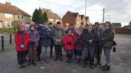
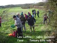
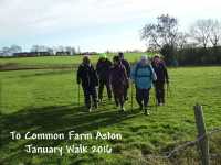
As the route unfolded, a variety of interest points availed themselves ranging from unseasonal plant activity to wide-ranging views of the countryside made available by the continuing good weather.
As we approached the end of our walk, the rooftops of Todwick suddenly appeared in front of us. At this point a shortened version of the walk was offered which was taken up by a few members of the party who were getting a little anxious about being in time for Sunday Lunch! The rest of the group continued to follow the programmed route by using various field paths for approximately another mile and half before finally returning to the centre of Todwick and the conclusion of the ramble.
Jim Tompkin
